
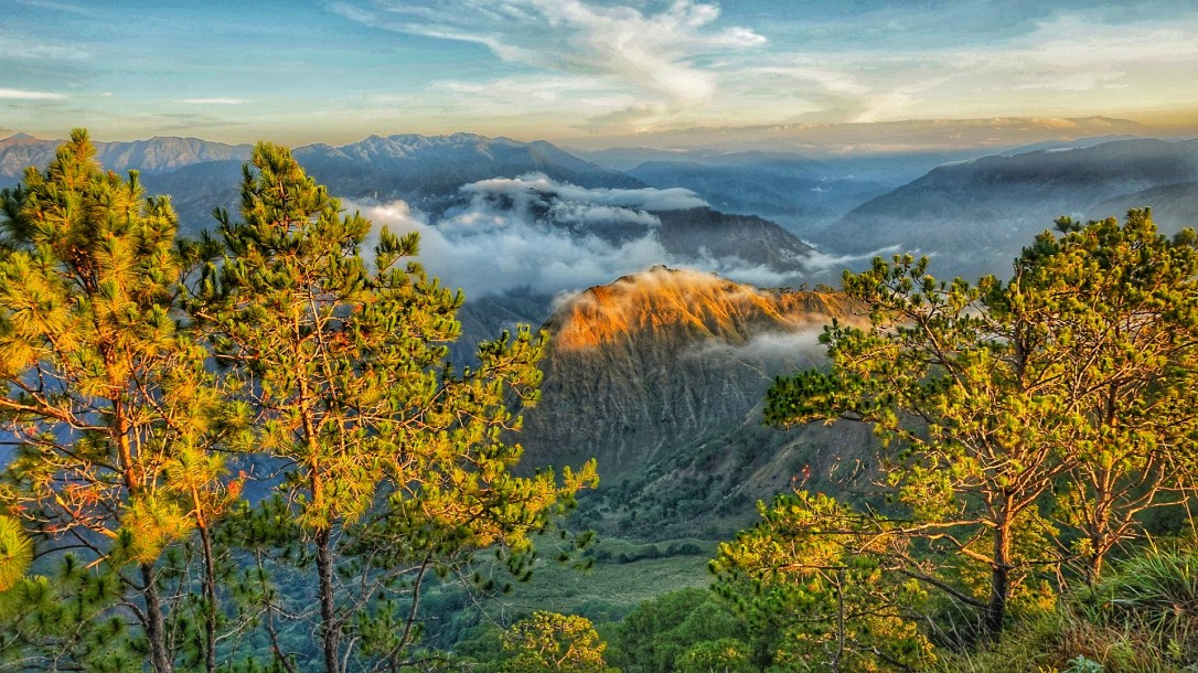
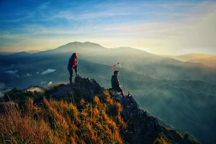
“Pigingan” in one of Cordillera’s local dialect means slanted, which describes the shape of the summit. It is not as popular as its neighboring mountains, Mt. Ugo and Mt. Ulap but it is really worth to give this a mountain a shot especially its main highlight, its beautiful sunrise. The hike to the summit may take 3-5 hours depending on your speed. The trail is friendly even for beginners in hiking since it is paved and sculpted. However the biggest struggle is the hot afternoon sun especially if you start the hike at midday. Pigingan is located in Barangay Dalupirip in Itogon, Benguet near Pangasinan so the temperature is warmer than other mountains of Benguet (we went there in the month of May). Plus the fact that the pathway doesn’t have much trees to shade the trail that slows down the hike. Day hike and overnight hike are both possible however the schedule of jeepneys going to the Sitio Balococ, the jump off is a big conflict so having a private vehicle is strongly recommended. I never heard of Mt. Pigingan before until my friends from Team Ladaw, a travel group on facebook introduced me to this mountain. They invited me to join their first Hike for a Cause event to raise funds for their upcoming outreach program. Of course, I packed my weekend bag and just go.
HOW TO GET THERE
- Jeepney to Dalupirip
- Jeepneys leaving from Baguio to Dalupirip starts from 10 a.m. – 12nn and vice versa is at 6 a.m. – 7 a.m. However, if the jeepney is full it will leave immediately without following the schedule so to be safe, be at their terminal in front of Shopper’s Lane at 9 a.m. Fare is ₱60 and travel time is 2 hours.
- Private Vehicle
- Strongly recommended since the schedule of jeepneys going and leaving Dalupirip is a conflict to day hikers and overnight ones. To get there take the Loakan Road to Virac, Itogon until you reach the twin river. From there you will see two separate roads, take the left road going to barangay Dalupirip then follow the road going up to Sitio Balococ, the jump off of the hike. Signs are visible so there won’t be much problem driving or getting lost.
WHERE TO STAY
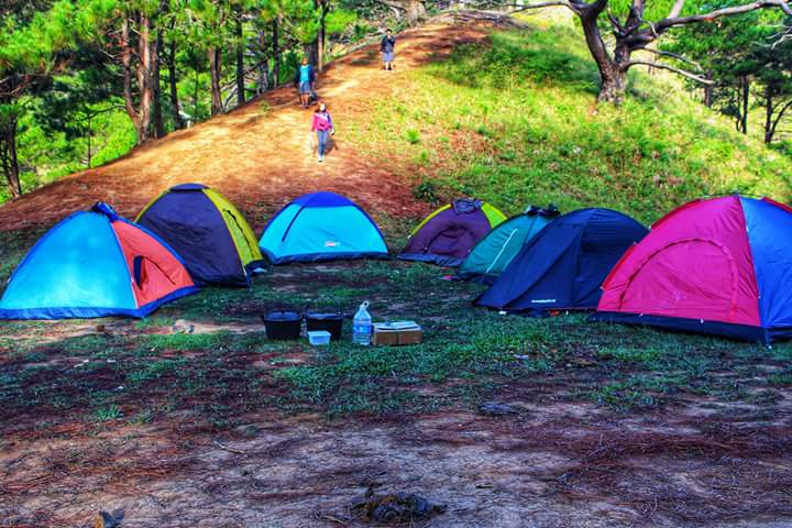
There is no any type of accommodation here so camping will be your only choice unless locals will offer their place for you to crash.
THE JOURNEY
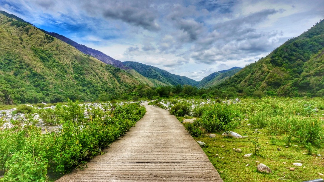
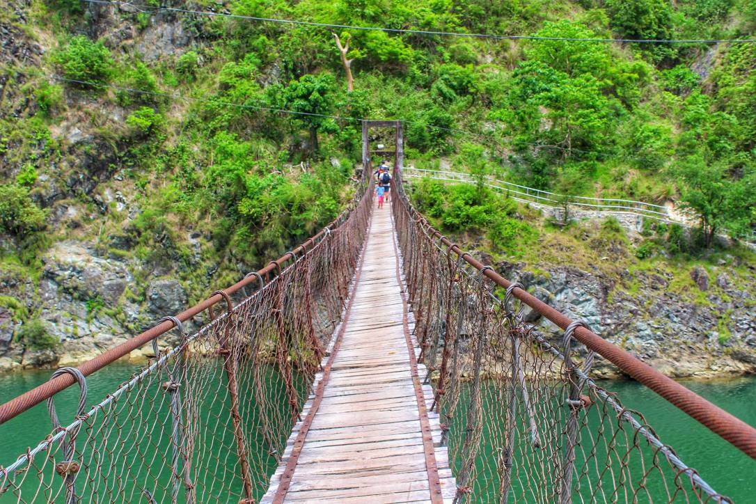
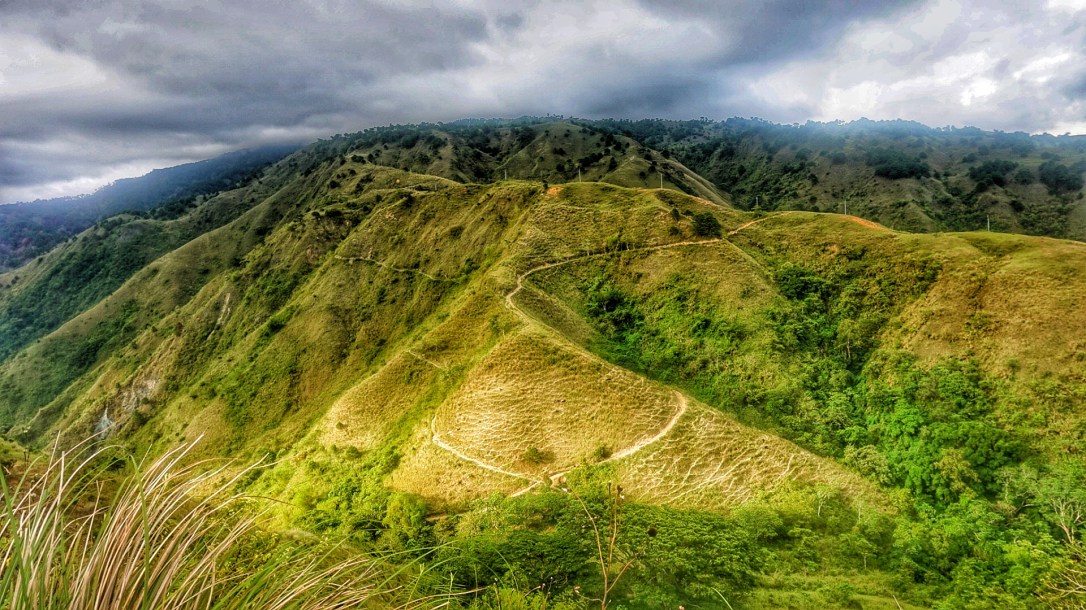
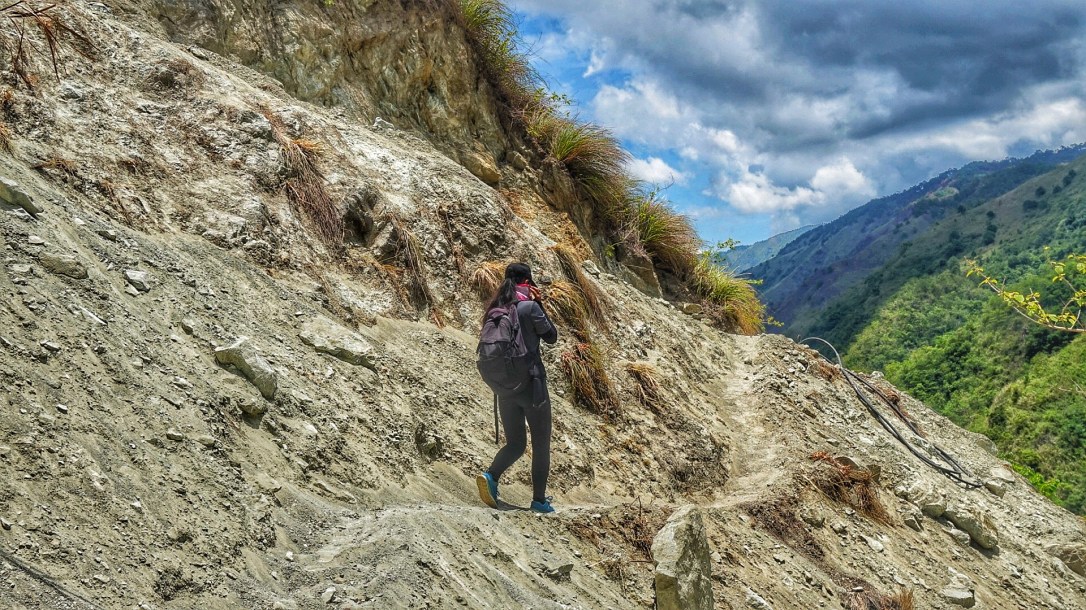
We departed Baguio City at 9:30 am and reached Sitio Balococ at around 11:45 considering the battle of traffic in Baguio. We had our registration, hiring of guide and porter and lunch. By 1 p.m. we started to walk. The first hour of our hike is a decent path with cemented road, crossing Agno River thru a long suspended bridge and purely straight flat trail. However the struggle here is the hot afternoon sun that makes the hike a bit slower and tiring. The next 2 hours is where the hike starts to be challenging, gradually as we ascend, the trail becomes steeper and the heat becomes stronger. We passed by some shaded part of trail to rest and refill our empty water bottles from their natural spring water sources. There are three water sources along the way before reaching the campsite. The trail in this part of the hike is mostly composed of soil and some loose sand.
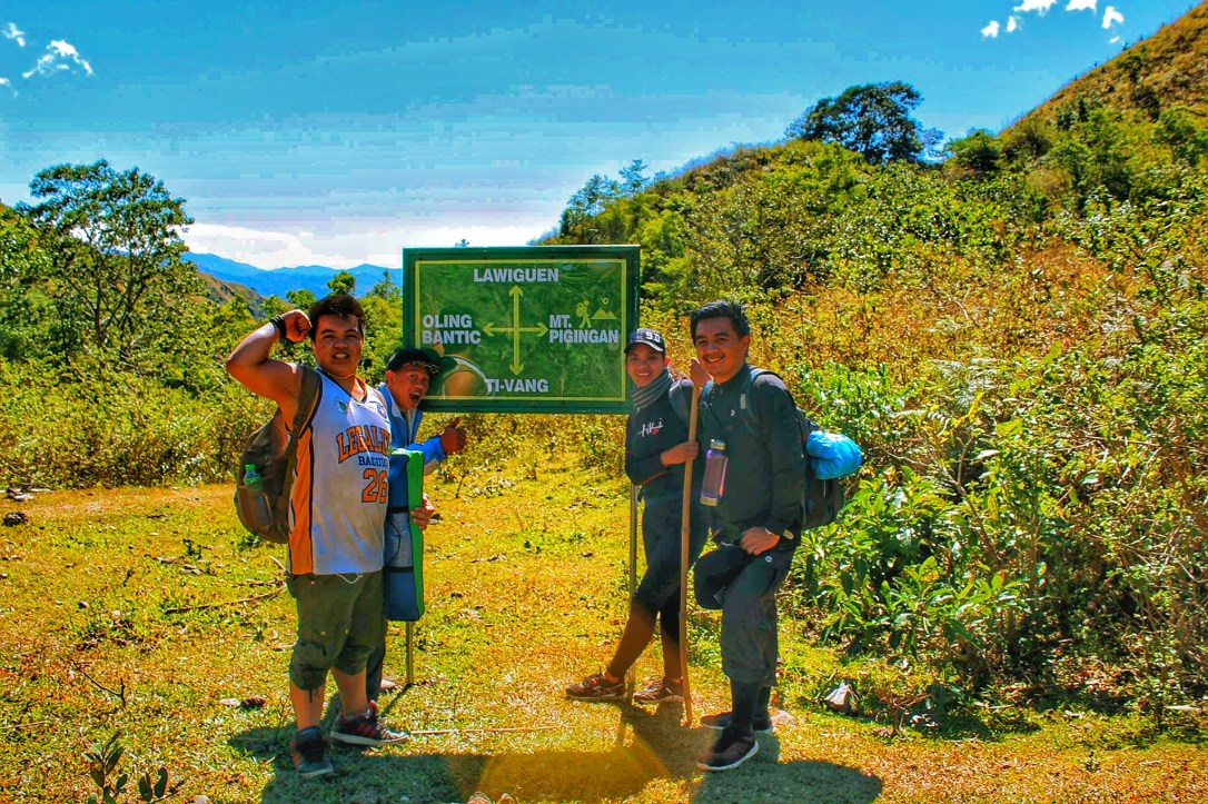
When we reach the junction we saw a signage of different trails to take. It also has a store that sells snacks and cold drinks. Starting this point was another one and half hour tougher and steeper trail to the campsite. Some parts of the trail are composed of loose soil but mostly are sturdy decent path. And again not much trees to protect us from the harsh sun but the views are more stunning with surrounding mountains.

We reached the campsite at around 5:30 pm so that was a 4 ½ hour of hiking with a normal pace and a lot of rest (LOL). Maybe if it wouldn’t have been because of the heat we could have reached the campsite earlier. Anyway 5 minutes from the campsite are the water source and toilet.
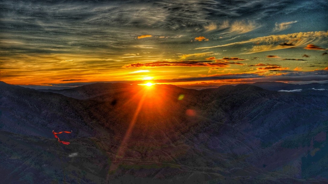
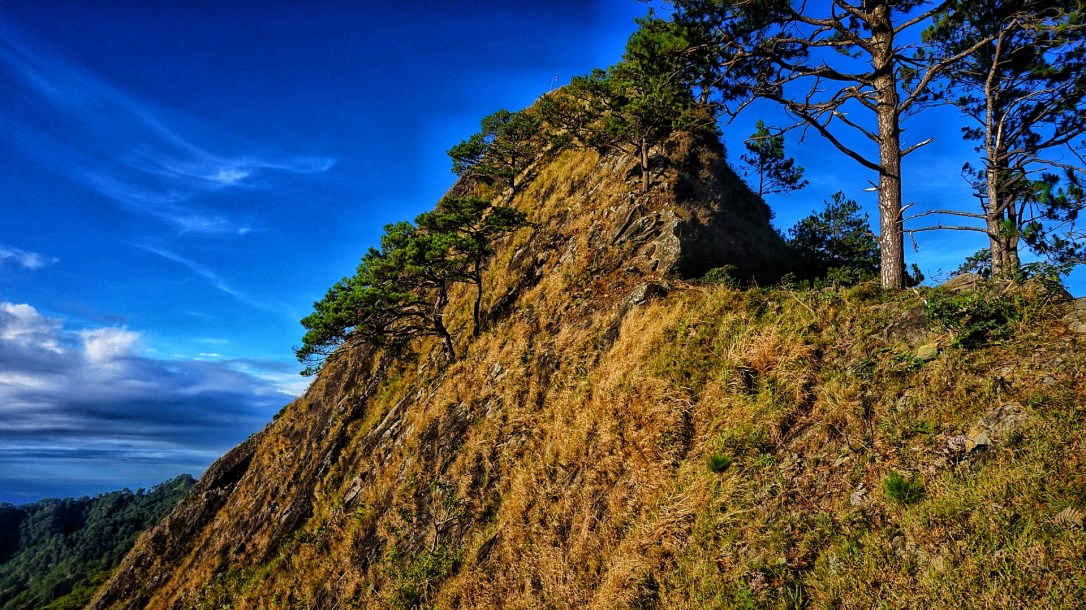
From the campsite is another 30 minutes trail to the peak of Mt. Pigingan. The trail going to the summit is easy but the peak is quite difficult since it was too steep. The highlights of this mountain are its generous sunrise and picturesque mountains surrounding it. On the right side you will find the sunrise while on the left are smaller but high definition resolution (HDR) mountains view.

ITINERARY (by TEAM LADAW)
Overnight
Day 1
8 am: Assembly (Slaughter, Magsaysay, BC)
9 am: Departure to Balococ
12nn: Arrival to Balococ (Lunch, Registration, Prepare to trek)
1 pm: Start trek
5 pm: Arrival at campsite (Tent set up, dinner, socials)
9 pm: Lights Off
Day 2:
3 am: Wake up call (Coffee)
4 am: Start trek to the summit
8 am: Back to the campsite (breakfast, pack up)
10am: Start to descend
1 pm: Arrival to Balococ (Lunch, Shower, Prepare to go home)
4 pm: Arrival in Baguio City
EXPENSES
Registration Fee: ₱100/ person
Guide: ₱ 500/ day max of 7 people
Porter: ₱ 500/ 15 kg (₱50/ 1 kg excess)
Shower Fee: ₱25
For more inquiries contact their barangay captain, Mr. Joel Bauson at 0947 521 2627 or person in charge Ms. Lanie Pastor at 0998 233 7994.
For guiding service contact Raven Pili (totally recommended) at 0950 145 8485
- Note: Signal is a big problem in Sitio Balococ so it may take a while before they could respond to your messages and calls.
For more hiking events visit Team Ladaw’s Facebook page.


❤️❤️❤️
LikeLike